City X
Abstract
City X is a multi-year research program that examines how contemporary urban life is organized by interacting systems of infrastructure, governance, economy, and morphology. Framed by the question “How do we live?”, the project treats design as an investigative method to expose relations between environmental stress, social precarity, platform logistics, and public institutions. Across teaching, studio work, and field analysis initiated at the Bernard and Anne Spitzer School of Architecture and developed within Architecture Field Lab (AFL), the study consolidates four rules of engagement—Coverage, Resiliency, Multiplicity, and Currency. These rules function as analytic lenses and as protocols for action, mapping distributions of services and risk, aligning ecological and social resilience, enabling programmatic and temporal hybridity, and re-articulating value and reciprocity at neighborhood scale. The work situates architecture as a mediator between policy and lived space, producing a framework that can be read, tested, and iterated across sites.

Context
City X emerges within a period marked by converging pressures often described as a perfect storm: accelerating climate risk, widening income and wealth disparities, demographic movement across regions, and the restructuring of daily logistics by data-driven platforms. These pressures are not parallel trends; they interact. Heat, flood, and air quality maps often overlap with indices of rent burden, displacement, and health vulnerability. Delivery networks, micro-warehousing, and ride-hail systems redraw curb space and street hierarchies, while municipal budgets and regulatory capacity struggle to track the redistribution of costs and benefits. The result is a city continuously reorganized by infrastructures that are partly visible and partly encoded, where political accountability and spatial consequences frequently diverge.
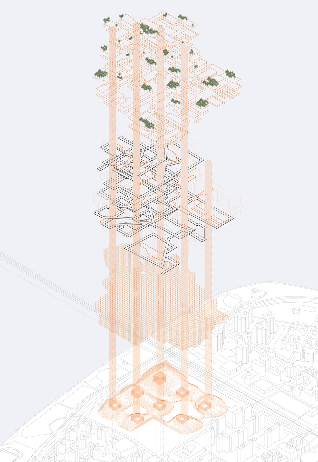
The program reads this condition through the long view of urbanism. Historically, form has followed systems as much as function: water and waste infrastructures produced grids and setbacks; finance produced tower-podium typologies; welfare states produced housing ensembles and service catchments. Today, the coupling of climate adaptation, public health, and logistics requires an equally systemic interpretation. City X therefore approaches the city less as an object and more as a matrix of relations, in which policy, procurement, maintenance, social practices, and ecological processes co-produce morphology.
The research draws from teaching collaborations, design charrettes, and iterative drafts that test ideas in specific sites while preserving a generalizable method. References to case material in New York City are used instrumentally: to trace service deserts and network bottlenecks, to evaluate opportunities for nature-based adaptation, to prototype multi-program thresholds, and to outline neighborhood value protocols. Each test contributes to a shared analytic language that can travel across contexts without erasing local particularities.
The question of how to live is operationalized as a question of who is served, when, and by what mechanism. Budget cycles, procurement rules, and maintenance contracts often determine spatial outcomes as effectively as zoning. When capital planning and operating budgets are separated, projects that perform well on life-cycle terms can be deprioritized despite delivering long-term public value. The research, therefore, reads financial and regulatory instruments as part of urban form. It also notes the rise of para-public actors—business improvement districts, conservancies, platform operators—whose decisions shape streets and facilities while bypassing ordinary deliberation. Mapping these governance paths clarifies which levers can be activated by design and which require policy change.
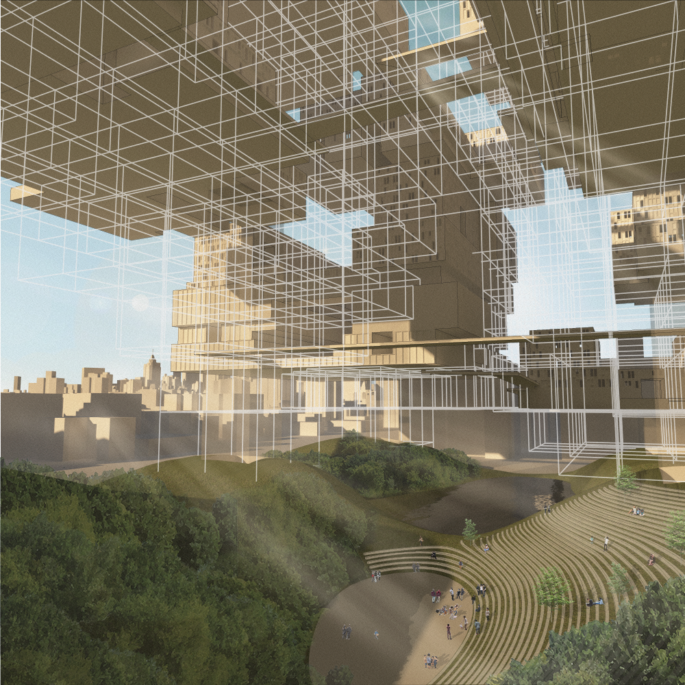
City X is informed by precedents in systems thinking and urban morphology but resists nostalgic typological solutions. Instead, it works to articulate interfaces that allow diverse actors to act in concert. The edge between building and street is a primary site of attention: where deliveries, waste, seating, planting, and access accumulate into conflict or reciprocity. Similarly, the roof is recast as a productive field for water detention, energy, and shade. Public interiors—schools, clinics, libraries—are treated as civic multipliers whose extended hours and shared systems can normalize access. These readings do not prescribe form; they propose a framework to interpret and adjust relations over time.
Methods
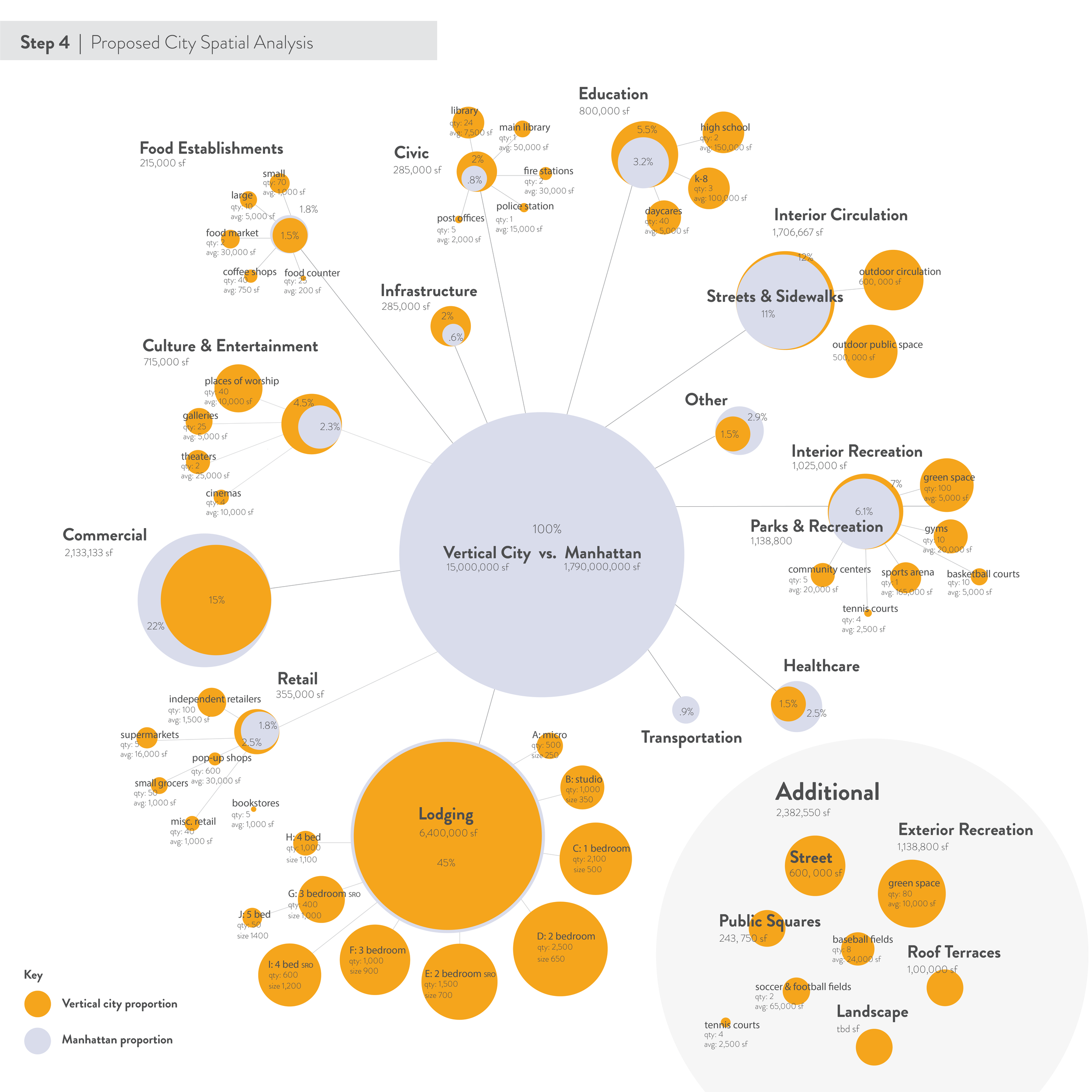
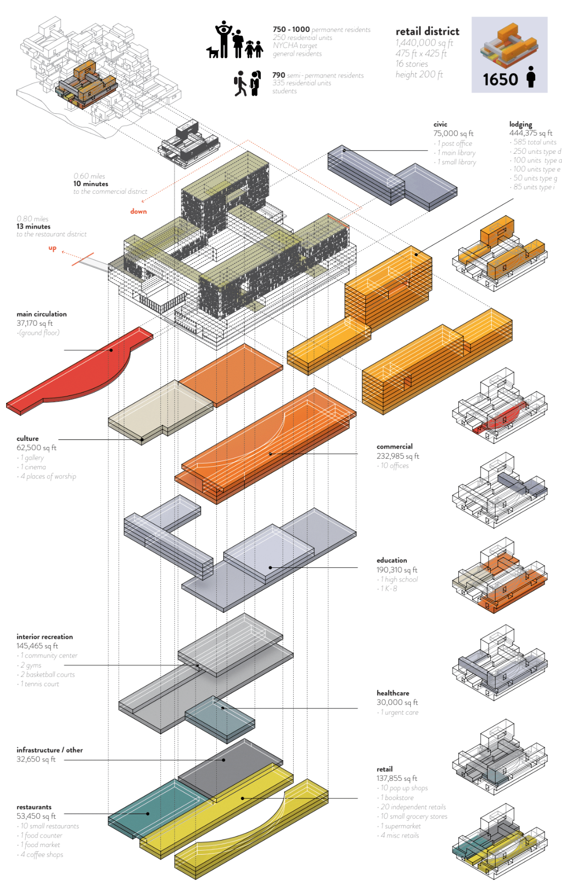
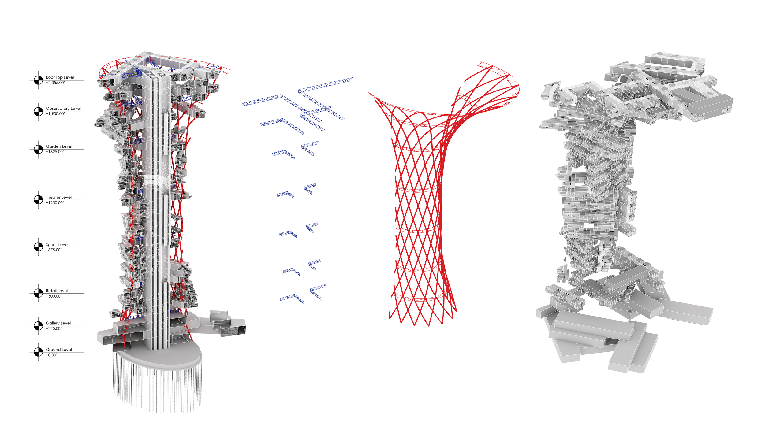
The project organizes its inquiry as a sequence of linked investigations. First, a coverage analysis establishes the distribution of essential services and exposures—public transport reach, school and clinic access, open space per capita, shade and heat islands, flood risk, air quality, curb allocation, and delivery loading zones. Each layer is mapped using consistent units and time frames to enable combinatory reading. Second, a resiliency analysis aligns ecological processes with social capacity, pairing hydrologic catchments, tree canopy, and soil permeability with indicators of household vulnerability, emergency response times, and service redundancy. Third, a multiplicity analysis identifies programmatic hybrids and temporal overlaps within buildings and blocks, tracing how spaces can carry several roles over a day, week, or season, and how building systems handle these transitions. Fourth, a currency analysis examines value formation and circulation at neighborhood scale: property tax increments, utility fees, platform rents, mutual aid, and public procurement.
The four analyses operate as both lenses and protocols. Each generates a set of diagrams, typologies, and if-then rules that link spatial decisions to systemic outcomes. Where data is incomplete, the method privileges transparency over speculation, indicating limits and proposing targeted ground truthing. The program uses comparative case reading, stakeholder interviews when available, and policy scans to verify feasibility. Outputs include relational maps, typological catalogues, scenario narratives, and stepwise implementation sequences that connect governance instruments to spatial effects.
Data handling follows a transparent pipeline. Sources are recorded with vintage and resolution, and each layer is normalized to shared units to avoid misleading overlays. Where administrative boundaries do not match lived geographies, the analysis uses hexagonal or grid tessellations to ensure comparability. Temporal coverage is made explicit; for example, collision or heat data is read as rolling means rather than isolated peaks. All assumptions and conversions are logged to permit replication.
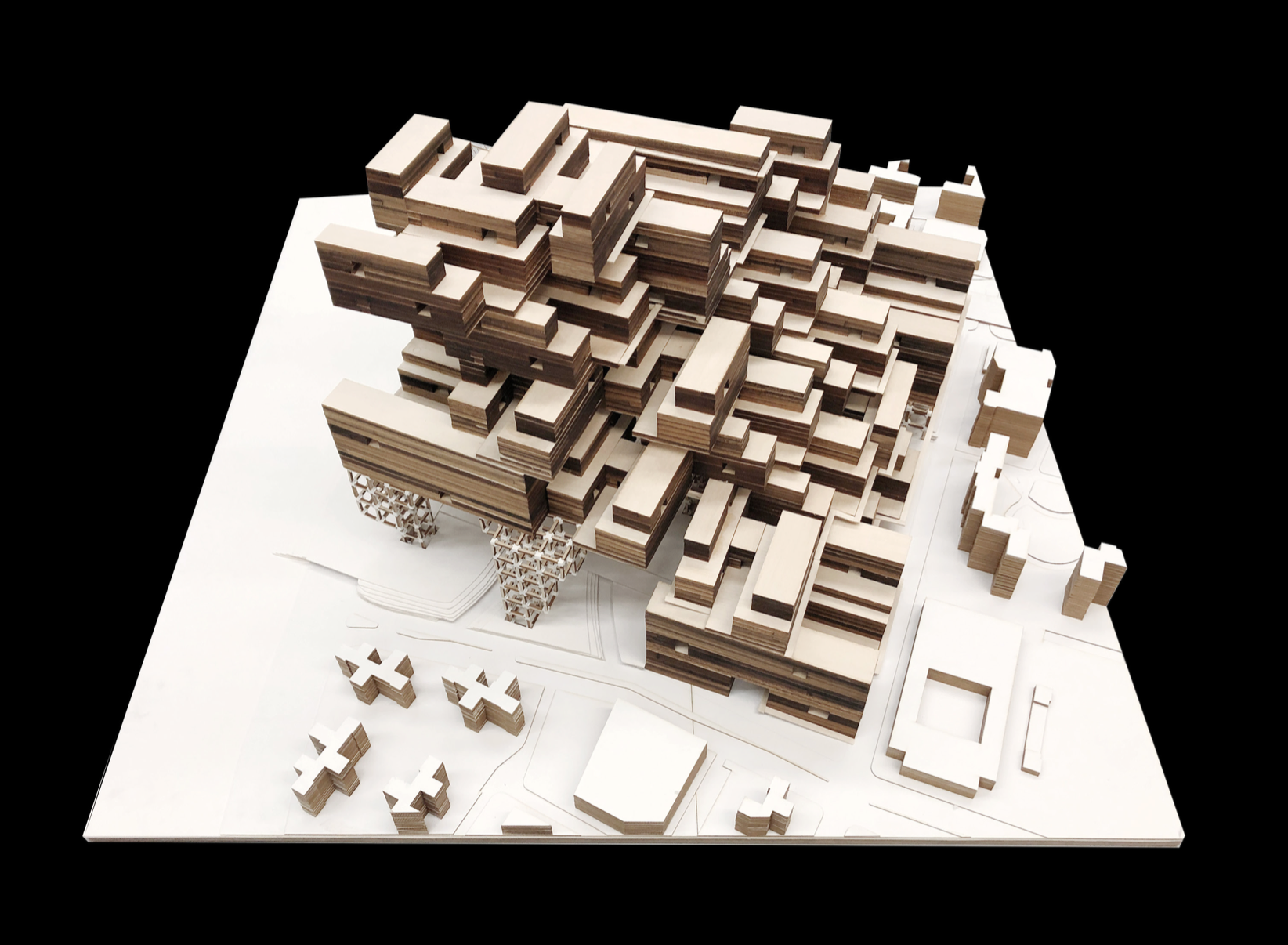
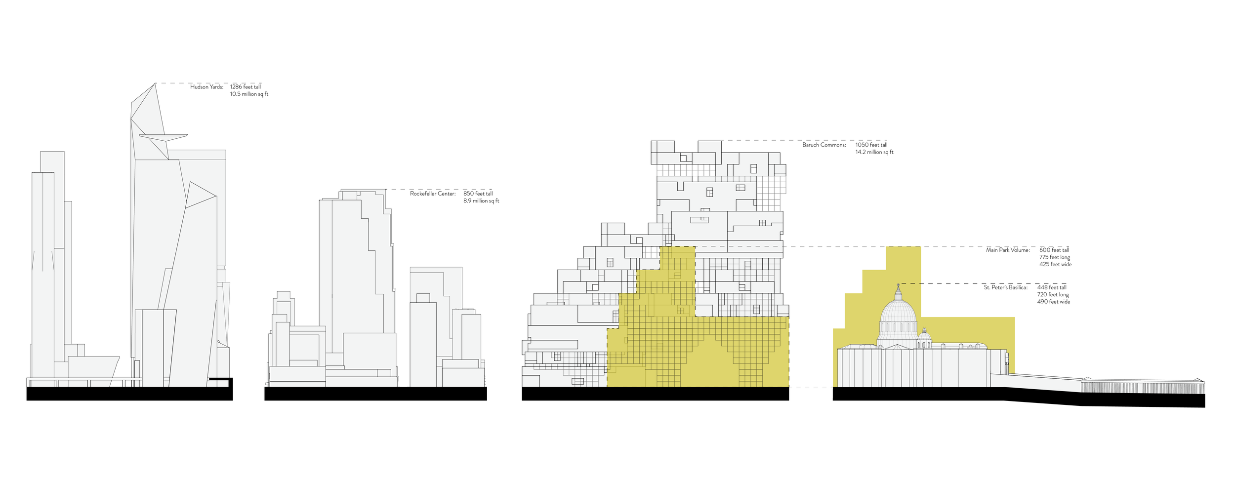
Typological work proceeds in parallel with mapping. For each lens, the team compiles a catalogue of spatial prototypes with quantified thresholds: tree density per block for thermal comfort, curb meters per land use for loading without spillover, detention volumes per hectare for first-flush storms, structural spans and shaft layouts that permit program switching. Prototypes are evaluated against operations: cleaning cycles, loading times, safety regimes, and staffing. Scenario drills link these prototypes to governance instruments, indicating which agency can authorize a change, how it is funded, and how maintenance is assigned. The final step packages the results into protocols that can be appended to briefs, requests for proposals, and community plans.


Findings / Reflection
Coverage. The coverage lens reveals how distributions of benefit and burden are structured by legacy investments, operational decisions, and emergent platform geographies. In many districts, the same blocks that lack shade, clinics, and affordable transit also absorb freight staging and high collision exposure. Mapping presence and absence on a uniform grid clarifies where marginal adjustments have low effect and where threshold changes—such as adding a frequent bus corridor, reallocating curb segments to loading at off-peak hours, or opening a schoolyard as weekend open space—unlock network value. Coverage is not a count of objects; it is a measure of accessible function over time. Design enters as the calibration of thresholds, interfaces, and sequences that raise the effective availability of essential services.
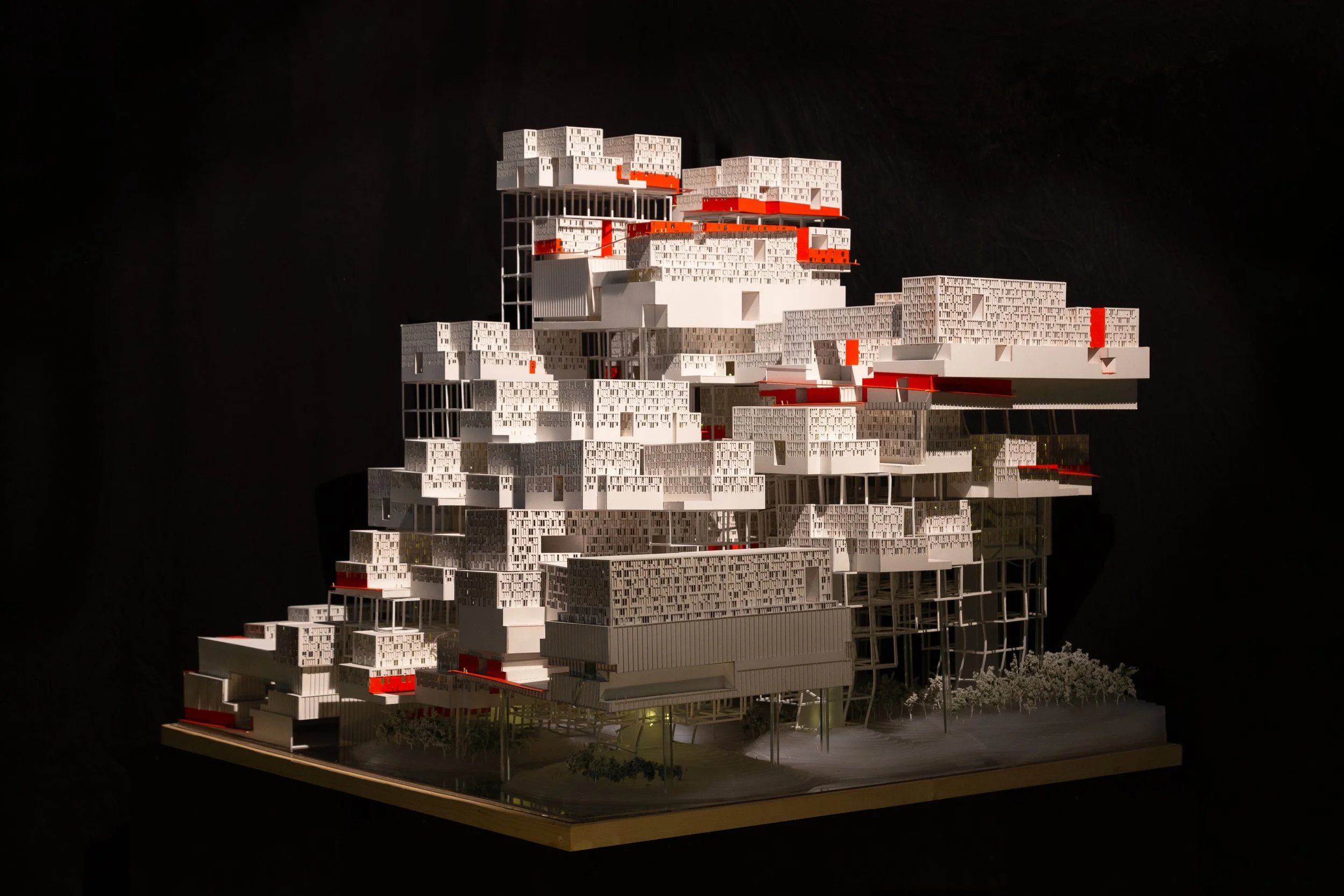
Resiliency. The resiliency lens couples ecological and social systems to replace single-hazard fixes with layered adaptations. Hydrology, soil, and canopy maps define the physical capacity of districts to absorb, slow, and cool, while social indicators identify where service interruption would compound vulnerability. From this coupling, the program derives a typology of distributed micro-infrastructures: sidewalk rain gardens aligned with bus stops and schools, retrofitted courtyards that detain and reuse stormwater, and greened logistics corridors that temper heat near loading. These are not isolated amenities; each is evaluated as part of a network, with maintenance roles assigned through clear stewardship protocols. The measure of success is redundancy and time to recovery rather than singular performance.
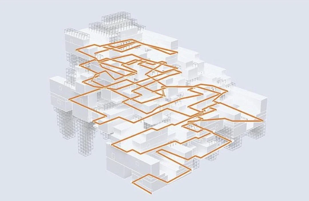
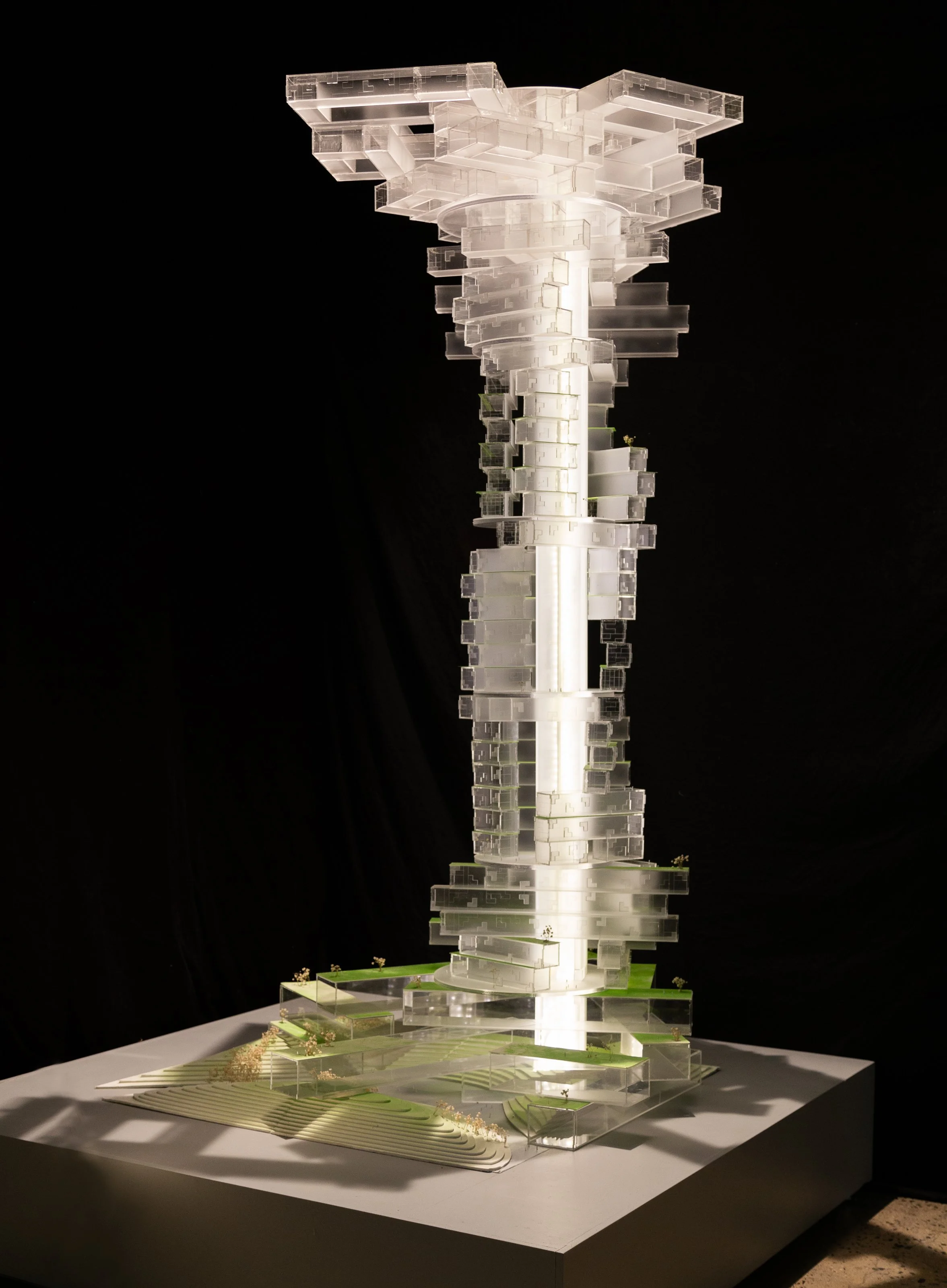
Multiplicity. The multiplicity lens examines how the same square meters can host different forms of publicness and production across time without overloading systems. Street edges are treated as programmable interfaces: morning delivery and waste staging, midday commerce and seating, evening play. Within buildings, structural grids, shafts, and egress are assessed for temporal switching, enabling classrooms to operate as cultural rooms after hours, clinics to share imaging suites, and workshops to support distributed manufacturing on weekends. The analysis emphasizes operational compatibility: how fire code, acoustics, and maintenance schedules align to make shared use viable. Multiplicity expands capacity without expansion of footprint by sequencing uses and clarifying responsibility.
Currency. The currency lens reframes value as a set of flows rather than a static asset. It tracks where neighborhood contributions accrue and where benefits return, comparing private extraction with public reinvestment. By reading property taxation, utility tariffs, platform fees, and procurement rules together, the analysis identifies leverage points for reciprocity. Examples include local reinvestment triggers tied to curb privileges, green infrastructure credits transferable within a district, and cooperative ownership of shared building systems that lower operating costs. Currency functions as governance clarity: it makes obligations and returns legible, aligns incentives across actors, and reduces leakage of value from districts that carry externalized burden.
Measurement. The framework links interventions to indicators that are legible to residents and administrators. For coverage: minutes to key services by time of day, percentage of curb dedicated to loading by hour, shade availability during peak heat. For resiliency: surface temperature reduction at pedestrian height, capture volumes for design storms, days to functional recovery after interruption. For multiplicity: hours of public availability per week for selected interiors, turnover times for program switching, maintenance incidents per quarter. For currency: local reinvestment ratios, cost savings from shared systems, and share of fees returned to stewardship. Public dashboards are proposed as accountability tools with each indicator tied to named responsibilities and update schedules.
Governance pathways. Approval and delivery sequences are mapped to minimize latency between decision and effect. Short-cycle actions—curb reallocation pilots, schoolyard openings, micro-canopy plantings—are paired with mid-cycle capital works such as green corridors and distributed detention. Long-cycle codes and procurement adjustments embed reciprocity and maintenance into routine practice. At each step, the framework asks which actor has agency, what instrument they control, and how that instrument interacts with others.
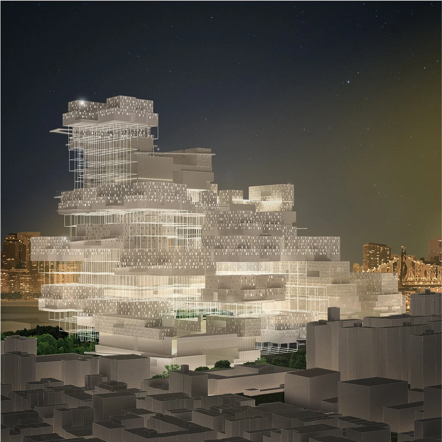
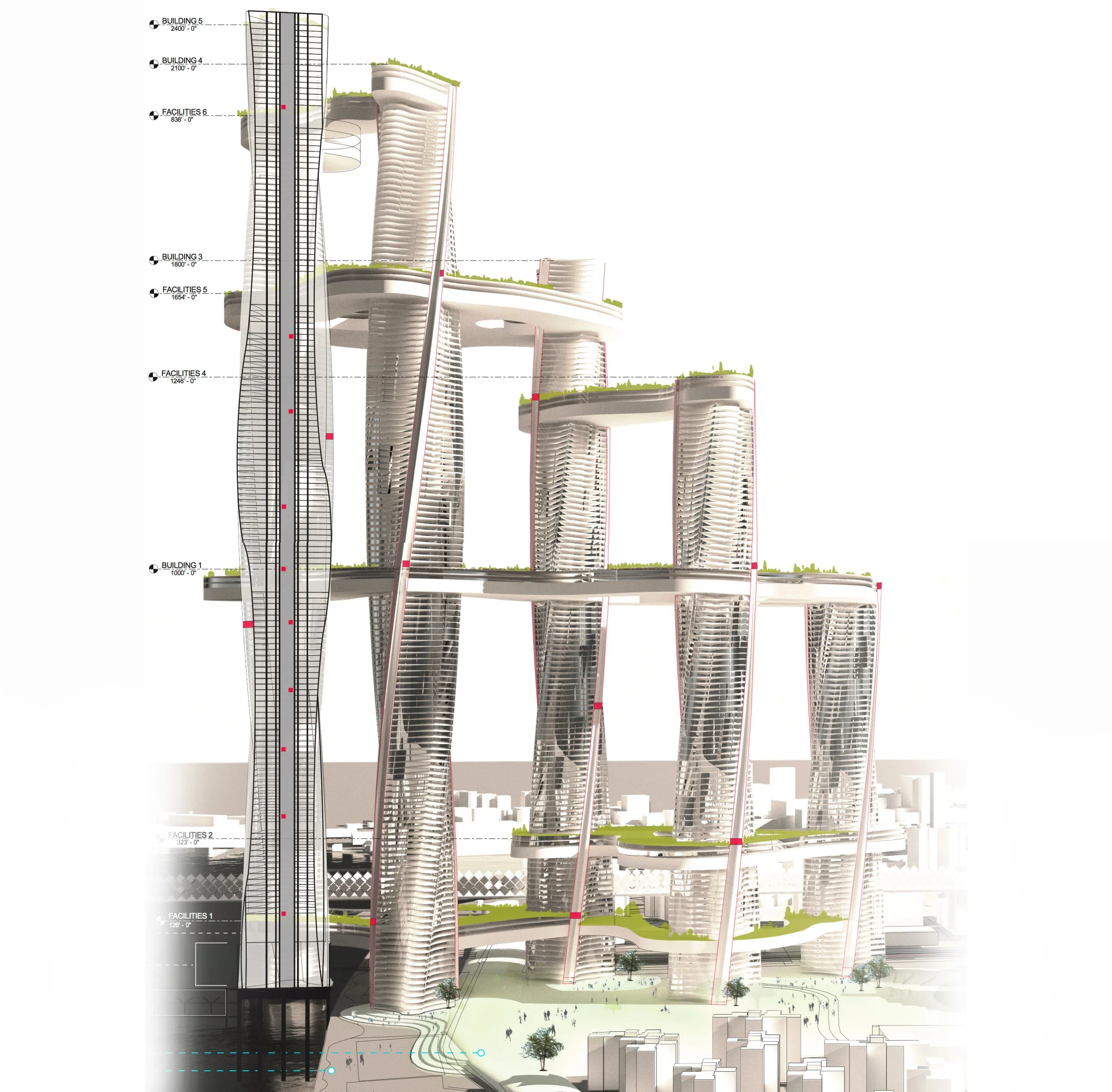
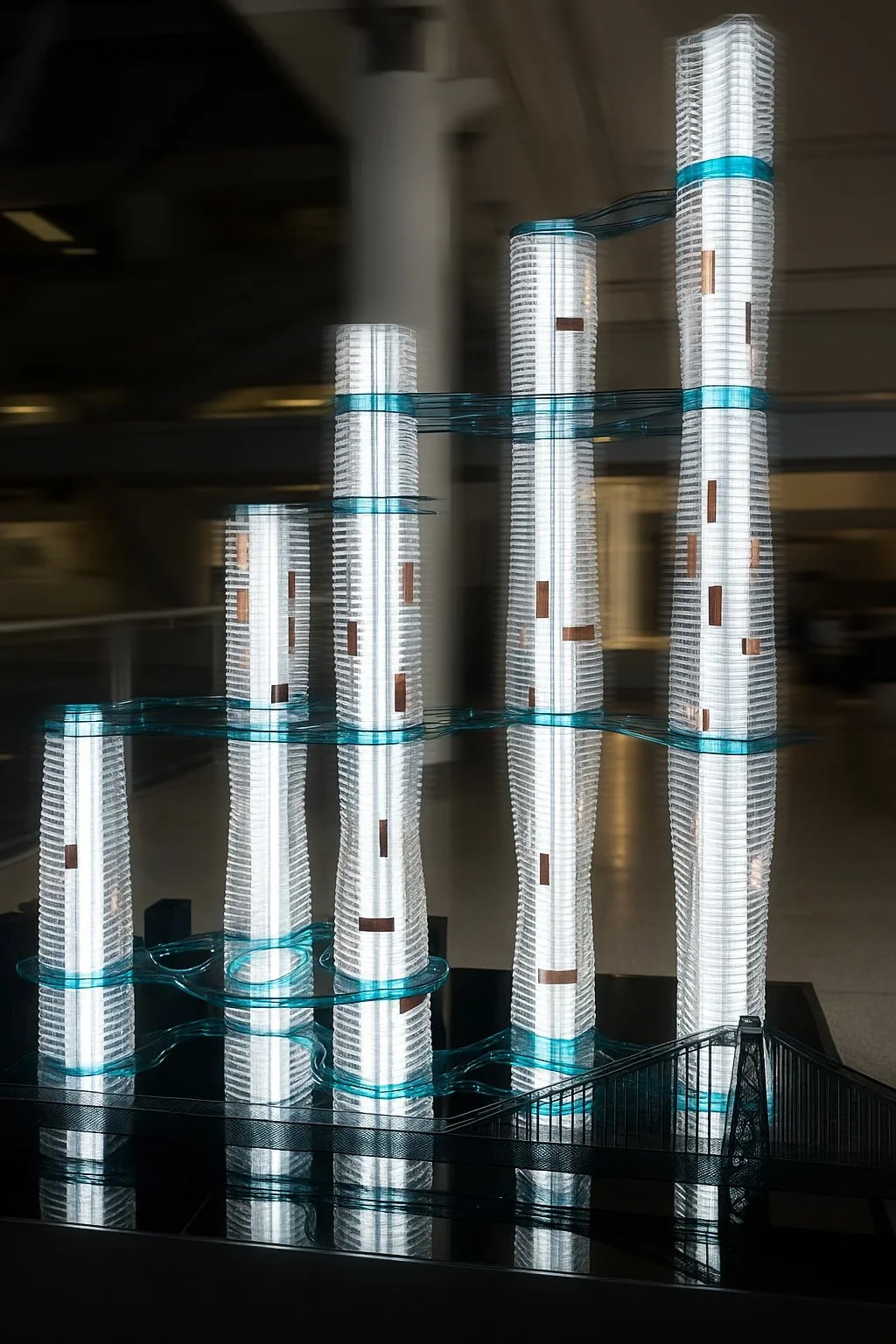
Spatial synthesis. Examples assembled during the study suggest that modest, well-sequenced changes can reorganize districts. A logistics corridor with timed loading, permeable paving, and aligned canopy can cool adjacent blocks while restoring sidewalk capacity. A school cluster with shared fields, open libraries, and coordinated after-hours access can raise service availability without new buildings. An assembly of hybrid thresholds—arcades, deep stoops, service bays—can stage deliveries and waste off the sidewalk while enabling small commerce. These are disciplined alignments of space, time, and responsibility.
Transferability. Although early testing draws on dense urban blocks, the framework is constructed to travel. Its reliance on shared units and thresholds allows adaptation to small cities and towns where block sizes differ and data may be limited. Where exhaustive datasets are absent, the method prioritizes sampling and conservative baselines over speculative precision. Reciprocity instruments are framed to comply with diverse legal contexts by emphasizing voluntary agreements and procurement design as much as regulation.
Learning loop. Pilots are treated as experiments with predefined evaluation windows and decision points for scaling, redesign, or retirement. Failures are recorded as adjustments to thresholds and protocols rather than as exceptions. Future work focuses on refining shared units across departments, formalizing stewardship roles, and extending the framework to places with limited administrative bandwidth.


Credits
Architecture Field Lab Research Program: Aleksandra Chepanova, Yennifer M Diaz Moscoso, Wafa Kaddour, Anna Lekanidis; Nicolas D Losi, Jacqueline S Love, Rudy Mejia, Nikitha Menon, Patrick Muldoon, Kenia Peralta, Sadie Rayne, Olivia Sklyarova, Brandon R Thompson, Sadie Wegner, Fengjing You
Collaborators: Kenneth King, Dennis C. K. Poon w/ Thorton Tomasetti, CetraRuddy Architects, and Chien Chung (Didi) Pei
Location: New York City
Year: 2021–2025
Contact: info@architecturefieldlab.org
CITY X Book in final development for publication